Mount Everest is located in the Mahalangur Himal subrange of the Himalayas in Asia, precisely on the border of Nepal and the Tibet Autonomous Region of China. Its summit, officially listed as 8,848.86 metres (29,031.7 feet) above sea level, lies on that international boundary. The mountain’s Nepalese side is situated above the Solukhumbu District in Koshi Province, in Sagarmatha National Park.
Because of that single sentence, Everest belongs to two countries and two cultures at the same time. Millions of people try to find it every year. Students looking at a map. Travellers deciding whether to go to Nepal. Trekkers wondering how close can they really get. It answers all those questions, from coordinates and names to viewpoints, climbing routes, Sherpa culture and practical planning in the Everest region.
Everest’s approximate coordinates are 27°59′17″ N latitude and 86°55′31″ E longitude, or 27.9881° N, 86.9250° E in decimal form. Latitude measures how far a place lies north or south of the equator; longitude measures how far it lies east or west of the Prime Meridian. Together they give a unique address for any point on Earth, which is why a summit as famous as Everest can be pinpointed on any map or GPS device.
The mountain belongs to the Mahalangur Himal, part of the Greater Himalayan system that curves across northern South Asia. Its summit lies on the boundary between Nepal and Tibet, at an elevation of 8,848.86 metres above mean sea level.
To find Everest on a world map, look north of the Indian subcontinent and south of the vast Tibetan Plateau. Move your eye to the narrow country of Nepal, wedged between India and China. Everest sits in Nepal’s far northeast, close to the top border line. On a map of Tibet, it appears along the southern edge of the plateau, near the Rongbuk Valley.
To clear up common confusion: Mount Everest is not in the Alps, and it is not in India or Pakistan. Pakistan is home to K2 and other giants of the Karakoram, while India has peaks such as Kangchenjunga on its border with Nepal, but Everest belongs to the Nepal–China frontier.
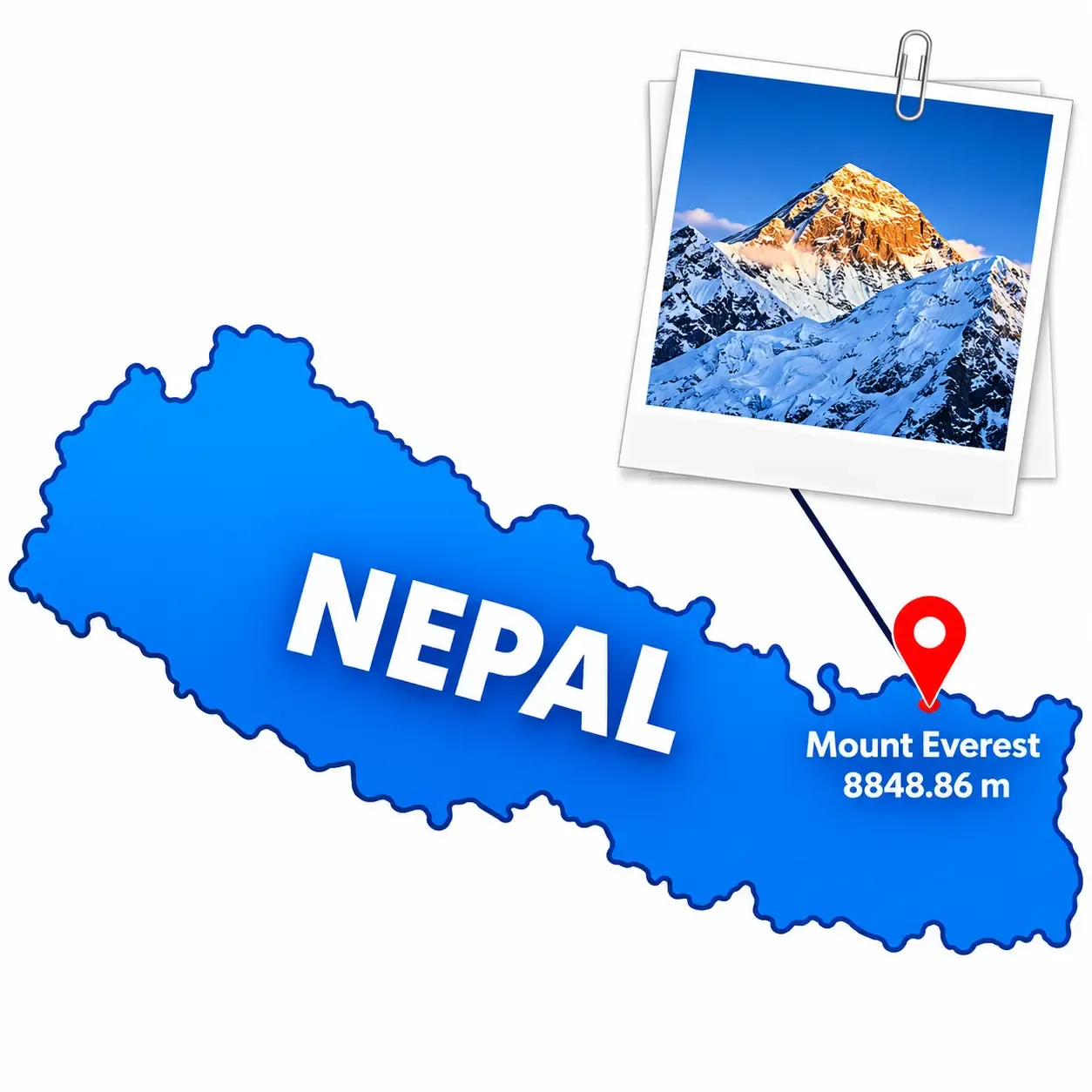
Yes, Mount Everest is in Nepal, with an important qualification: the summit lies on the border, so Nepal shares the mountain with China. On the Nepalese side, Everest stands in the Khumbu region of Solukhumbu District, in Koshi Province, in the northeastern part of the country. The entire Khumbu area is protected as Sagarmatha National Park, a UNESCO World Heritage Site.
In Nepali, Everest is called Sagarmatha (सगरमाथा), and the region around it is one of the most visited mountain areas on Earth. The geography is easy to picture once you follow the trekking route. The Dudh Koshi River drains the valley, and settlements such as Lukla, Phakding, Namche Bazaar, Tengboche, Dingboche and Lobuche climb gradually towards Gorak Shep, the last settlement before Everest Base Camp. Base Camp itself sits on the Khumbu Glacier, beneath the Khumbu Icefall, at the foot of the climbing route.
A useful distinction: Everest Base Camp is not the summit. The camp lies at roughly 5,364 metres, while the top of the mountain is more than 3,400 metres higher and is invisible from the camp itself, hidden behind the shoulder of Nuptse and the Lhotse–Everest wall.
So, to answer the common searches directly: Everest is in Nepal (and China), in Solukhumbu District, in Koshi Province, and not in India.
The mountain carries three widely used names, each reflecting a different history.
Mount Everest. The English name honours Sir George Everest, a British Surveyor General of India. After the Great Trigonometrical Survey identified the peak, previously recorded as Peak XV, as the world’s highest, Andrew Waugh, Everest’s successor, proposed naming it after his predecessor in the 1850s. Everest himself reportedly objected, partly because the name could not be written in local scripts.
Sagarmatha. This is the official Nepali name, commonly translated as “Forehead of the Sky” or “Goddess of the Sky.” It was popularised in the 1960s as Nepal sought a national name for a mountain that had previously been known to the outside world mainly by its English one. Translations and the exact origin of the word are discussed by scholars, so it is best treated as a modern national name with deep sky-and-sea imagery.
Chomolungma / Qomolangma. The Tibetan name is long established and is often translated as “Holy Mother” or “Goddess Mother of the World,” although translations vary. The Chinese form is Qomolangma, and the mountain has real spiritual meaning in Tibetan Buddhist tradition.
Different communities use different names because they came to the mountain through different languages, histories and relationships with it. Local people knew it long before surveyors named it.
The official height of Mount Everest is 8,848.86 metres above mean sea level. Nepal and China jointly announced that figure in December 2020, ending a long period during which each country used a slightly different number.
Measurement | Mount Everest Height |
|---|---|
Metres | 8,848.86 m |
Kilometres | 8.84886 km |
Feet | 29,031.7 ft |
Miles | Approximately 5.50 miles |
For decades, the commonly accepted figure was 8,848 metres, derived from an Indian survey in the 1950s. China had published a figure of 8,844.43 metres after a 2005 measurement that measured rock height, excluding the snow cap, while Nepal used the older number. The 2020 agreement settled on a shared value measured from the summit’s snow top.
Modern surveyors combine several tools. GNSS and GPS receivers fixed on the summit record its exact position, traditional levelling and trigonometry connect the mountain to known benchmarks, and gravity measurements help define mean sea level, because the sea surface is not perfectly uniform. Nepal’s survey team and Chinese teams also took independent readings before comparing results.
Mountain height is always measured above mean sea level, not from the base of the mountain. That is why Everest, not a mountain with a taller base-to-peak rise such as Mauna Kea, is called the highest mountain above sea level.
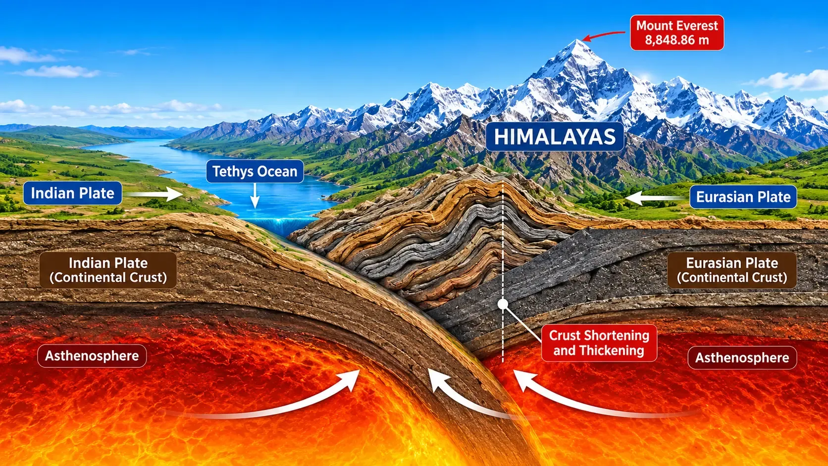
The Himalayas exist because the Indian tectonic plate is pushing north into the Eurasian plate. Neither plate can easily sink beneath the other, so the crust has been crumpled and thrust upward for roughly 50 million years. That collision is ongoing, which means the mountains are still being uplifted.
But Everest is not rising by a neat fixed amount each year. Uplift is pushing the range up, while erosion, glaciers, landslides and weathering wear it down. Earthquakes can shift the crust abruptly, and the 2015 Gorkha earthquake moved parts of the region measurably. Research on regional river changes, including the capture of the Arun River by the Kosi system, suggests that unloading of the crust may add a little extra lift over very long timescales.
Measurements add another layer. A change in the reported height can reflect better equipment, different reference systems or a different decision about whether to include snow, not necessarily real movement. Scientists generally describe Everest’s rise as slow, small and uneven, measurable over geological time rather than something visitors will notice.
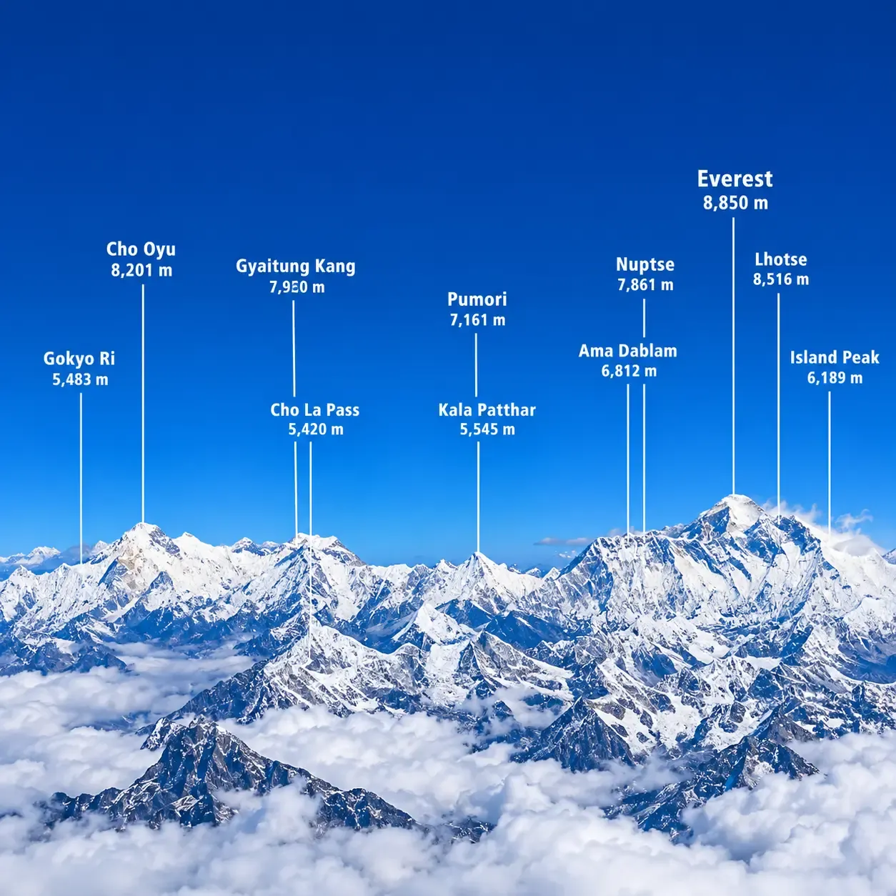
Everest sits among some of the world’s highest peaks, though not all of them touch it. Approximate elevations are:
Lhotse (8,516 m): the fourth-highest mountain on Earth, joined to Everest by the South Col.
Nuptse (7,861 m): the long wall that forms the southern side of the Western Cwm.
Changtse (7,543 m): the “North Peak,” which sits on the Tibetan side next to the North Col.
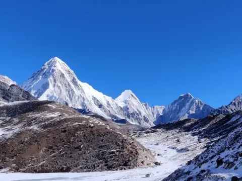
Pumori (7,161 m): close to Kala Patthar, which many trekkers use for views of Everest.
Ama Dablam (6,812 m): a spectacular, pyramid-shaped peak that dominates the trail to Tengboche and Dingboche but is not directly connected to Everest.
Cho Oyu (8,188 m): about 30 kilometres west, accessible from the Gokyo valley region.
Makalu (8,485 m): around 20 kilometres to the southeast, in a separate valley.
Lhotse, Nuptse and Changtse are directly connected to Everest’s ridges. Pumori and Ama Dablam stand nearby but are separate peaks, and Cho Oyu and Makalu lie farther away along the Himalayan chain.
The best viewpoint depends on how much time, fitness and altitude tolerance a traveller has.
Kala Patthar. At roughly 5,545 metres above Gorak Shep, this black rocky ridge is the most popular trekking viewpoint for a close, direct look at Everest’s summit pyramid. Sunrise light and late afternoon glow make it a favourite with photographers, although the climb is demanding at that altitude.
Everest Base Camp. At about 5,364 metres on the Khumbu Glacier, base camp offers the experience of standing at the foot of the route, with the Khumbu Icefall above. The summit itself is not clearly seen from here, which is why Kala Patthar generally offers the better Everest panorama.
Hotel Everest View. Located near Syangboche above Namche Bazaar at around 3,880 metres, it offers a wide panorama of Everest, Lhotse and Ama Dablam. It can be reached on foot from Namche or, in some cases, by air via the nearby Syangboche airstrip, so it suits travellers who want views without extreme altitude.
Gokyo Ri. At about 5,357 metres above the Gokyo Lakes, this viewpoint gives a sweeping panorama that includes Everest, Lhotse, Makalu and Cho Oyu. It is the highlight of the Gokyo Lakes trekking route.
Namche Bazaar. The main trading and acclimatization hub of the Khumbu, at roughly 3,440 metres, has viewpoints close to town and is an easy base for the short walks up towards Hotel Everest View.
Everest Mountain Flight. Scenic flights leave from Kathmandu and fly along the Himalaya for about an hour, giving aerial views of Everest without a trek. They are weather-dependent, so schedules can change.
In short: Kala Patthar suits trekkers who want the classic view, Gokyo Ri suits those who prefer lakes and fewer crowds, Hotel Everest View and Namche suit slower, shorter trips, and the mountain flight suits travellers short on time.
There are two standard routes to the summit. Both finish at the same point but start from opposite sides of the border.
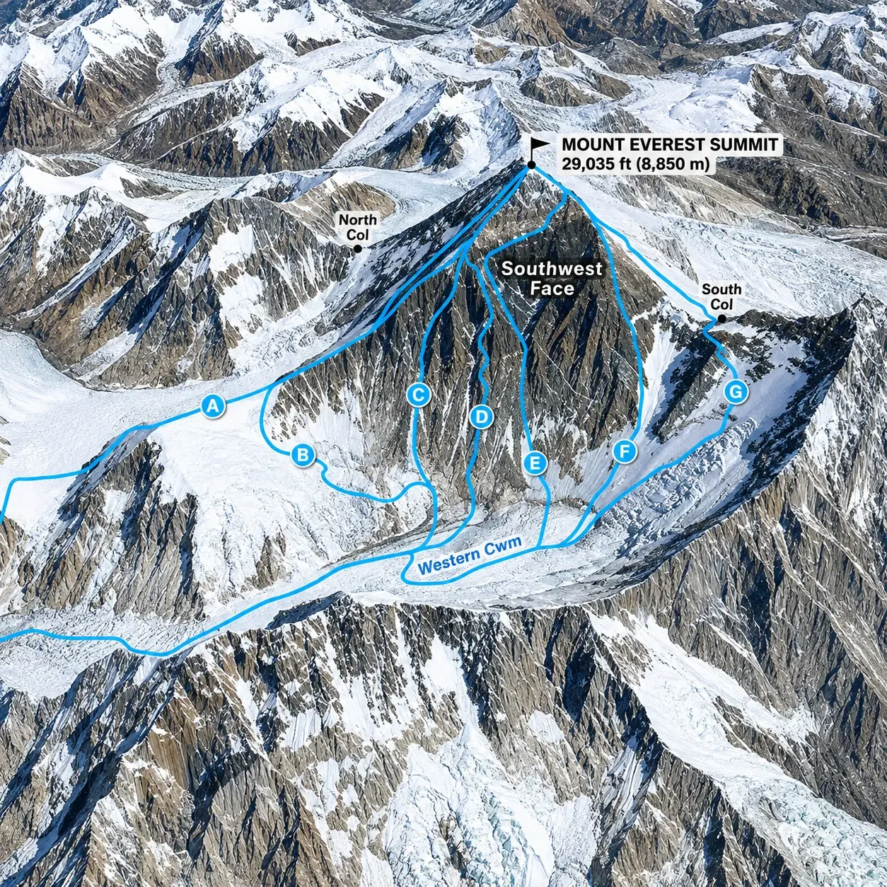
The Nepalese route begins at Everest Base Camp and crosses the Khumbu Icefall, a moving glacier that is regarded as one of the most hazardous sections. Climbers then enter the Western Cwm, a glacial valley, before ascending the Lhotse Face to reach the South Col, the high saddle between Everest and Lhotse. The final approach follows the southeast ridge towards the summit, passing the area long associated with the Hillary Step, a rock feature whose appearance is reported to have changed in recent years.
The challenges are altitude, weather, icefall hazards and the need for long acclimatization. It is the most commonly used commercial route because of its established infrastructure.
The Tibetan route starts from the North Base Camp in the Rongbuk Valley, which can be reached by road. Climbers move up to the North Col, then follow the North Ridge and Northeast Ridge to the summit. The terrain is more exposed to wind, and the route is generally colder, with different logistics shaped by permits and Chinese regulations.
In general terms, the south has the icefall and a glacial approach, while the north has long exposed ridges. We deliberately do not describe technical climbing methods here; this guide is about geography and history.
British reconnaissance in 1921 explored approaches from Tibet, followed by expeditions in 1922, which was the first to use bottled oxygen and reached about 8,320 metres, and in 1924. In June 1924, George Mallory and Andrew Irvine disappeared high on the mountain. Mallory’s body was found in 1999, but Irvine’s was not, and no confirmed evidence shows whether they reached the summit. That question remains unresolved.
On 29 May 1953, New Zealander Edmund Hillary and Sherpa mountaineer Tenzing Norgay reached the summit as part of the British expedition led by John Hunt. It is the first widely confirmed ascent, and its significance lies in the technical difficulty, the international cooperation and the fact that it ended a three-decade quest.
Afterwards, more milestones followed: the first confirmed ascent from the north in 1960, Junko Tabei’s ascent as the first woman in 1975, and Reinhold Messner and Peter Habeler’s climb without bottled oxygen in 1978. From the 1990s, commercial expeditions grew rapidly, turning Everest into a destination with both great opportunity and growing concern about crowding and safety.
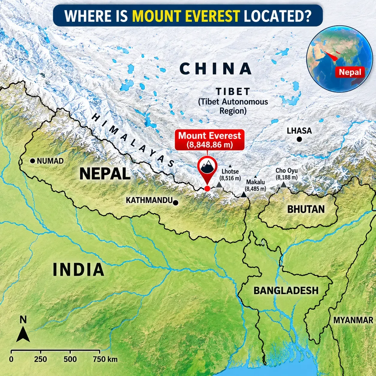
Everest sits on the international border between Nepal and China’s Tibet Autonomous Region. The southern slopes and the approach to the South Col lie in Nepal, while the northern slopes, the Rongbuk Glacier and the North Col lie in Tibet. The boundary runs across the summit ridge, so the highest point is shared rather than owned by one country.
That answers the usual questions. Everest is in Nepal and in China (Tibet). No single country owns the entire mountain, and saying it belongs exclusively to either one is inaccurate. Nepal calls it Sagarmatha, China and Tibet call it Qomolangma or Chomolungma, and both treat it as a national symbol.
Mount Everest is in Asia. It stands in the Himalayas, on the southern edge of the Tibetan Plateau, where South Asia meets Central and East Asia. The Himalayas are a mountain range, a chain more than 2,000 kilometres long, and Everest is one mountain within it. The two are not the same thing: saying “the Himalayas” refers to the whole range, while Everest is its highest peak.
Three kinds of distance get mixed up, so it helps to separate them. The straight-line distance from Kathmandu to Everest is roughly 160 kilometres. That is not how anyone travels, because the mountains and valleys in between make the real route far longer.
The usual route to Everest Base Camp starts with a flight from Kathmandu to Lukla, a short mountain flight that is highly weather-dependent. In busy seasons, some flights operate from Ramechhap (Manthali) instead, which adds a road transfer, so confirm the departure point with your operator. From Lukla, trekkers walk for several days, with acclimatization stops in places like Namche Bazaar, to reach Base Camp. Trekking distances are often quoted at around 60 kilometres one way from Lukla, but they vary by source and route. Most itineraries run for about two weeks in total. Check distances and timings with your trekking operator rather than relying on a single figure.
Generally no. From central Kathmandu, Everest is too far away and hidden behind intervening ranges. On exceptionally clear days, a few high viewpoints on the valley rim, such as Nagarkot, are said to offer a distant glimpse, but it is not reliable and not visible from every hill. For a real view, travellers choose one of three options: a mountain flight, a trek in the Khumbu, or a helicopter tour.
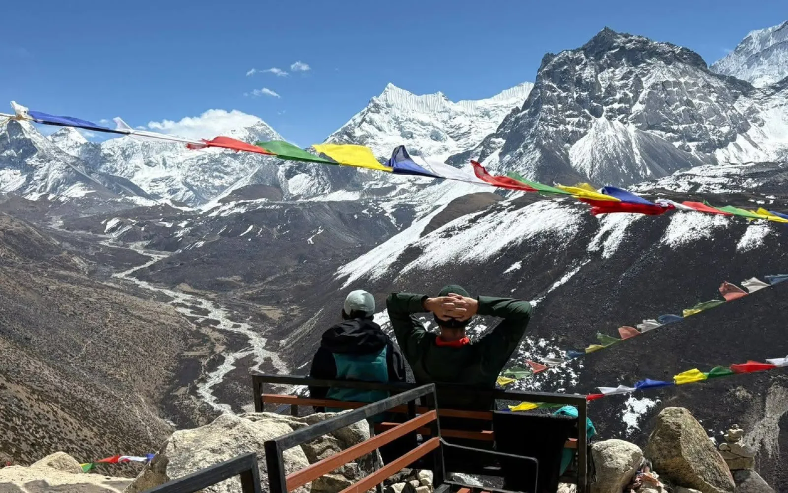
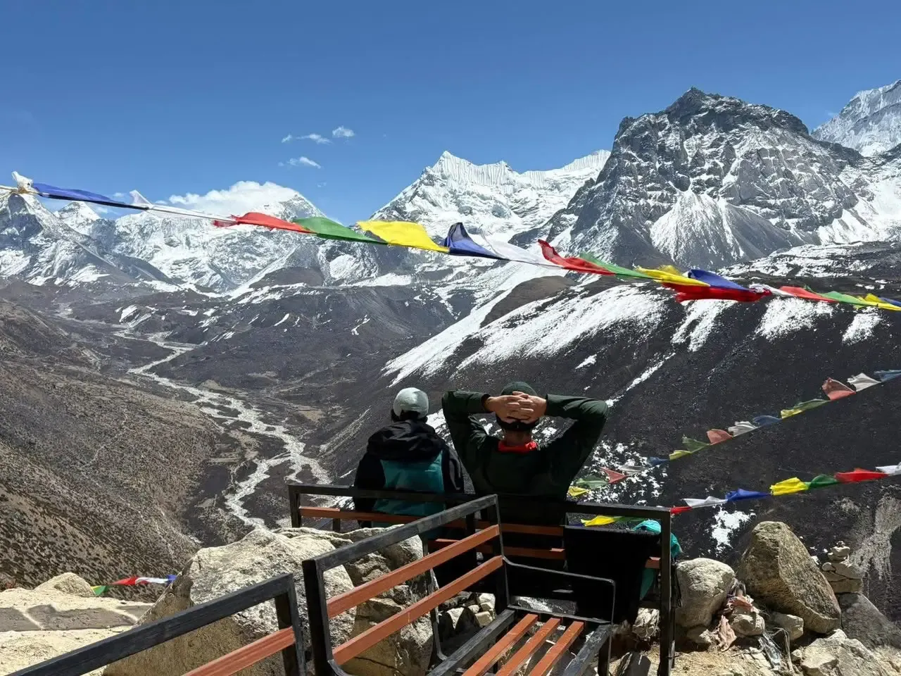
On the standard route, the early days in Phakding and Monjo focus on forest and river valleys, and Everest is not visible. The first views usually come above Namche Bazaar, near Hotel Everest View and the nearby ridges, though only as a distant peak behind Nuptse and Lhotse. The views improve at Tengboche and Dingboche, and the closest views come at Gorak Shep and Kala Patthar. Visibility depends on weather, season and route variations, so mornings are usually clearer.
Several options work for people who do not want the full trek.
Everest Mountain Flight: fast, with sweeping aerial views, but you stay in the plane and cannot choose the weather.
Hotel Everest View: a high panorama and a comfortable stop, but views depend on cloud, and the altitude can still affect some people.
Namche Bazaar: a lively market town with nearby viewpoints, though Everest appears small from here.
Tengboche: a monastery setting with a stunning mountain backdrop and a more direct view of Everest, Lhotse and Ama Dablam.
Gokyo Ri: a superb panorama, but it requires an alternative route and good fitness.
There is no single answer, because it depends on the reference point. Gorak Shep, at about 5,164 metres, is the last settlement before Base Camp and is the closest regular settlement on the trekking route, while Lobuche and Dingboche lie farther down the valley. Namche Bazaar is the main hub, and Thame is a historic Sherpa village in a side valley. On the Tibetan side, the Rongbuk area has a monastery and a camp. Rather than naming one place as the absolute closest, it is more useful to think of these as stepping stones on the way.
Neither is universally better. The right choice depends on what you want.
Accessibility: the Nepal side is reached by flight and trek, while the Tibetan side can be reached by road, subject to regulations.
Trekking: Nepal offers a multi-day trek through Sherpa villages, while Tibet offers a shorter, vehicle-based visit.
Base Camp experience: Nepal’s camp sits on a glacier and is reached on foot, while Tibet’s North Base Camp has a road leading to it.
Views: the north face is seen clearly from the Tibetan side, while the Nepal side offers Kala Patthar and the surrounding peaks.
Culture: Nepal offers Sherpa culture, while Tibet offers Tibetan Buddhist monasteries.
Permits and rules: Tibet generally requires a special permit and organized travel, and rules change often, so check current requirements before booking.
Infrastructure: Nepal has teahouses along the route, while Tibet has more limited accommodation near the base camp.
Travellers who want a classic trek and cultural immersion tend to choose Nepal, while those with limited time and a flexible itinerary may consider Tibet.
The Everest region offers several ways to experience the mountain.
Everest Base Camp Trek: the classic route, usually about two weeks, with moderate-to-demanding days at altitude.
Everest Gokyo Lakes Trek: a quieter route through turquoise lakes, ending at the Gokyo Ri viewpoint.
Gokyo and Everest Base Camp via Cho La Pass: a more challenging loop that combines both valleys and crosses a high, glaciated pass.
Everest Three Passes Trek: a demanding circuit across three high passes for experienced trekkers.
Everest Mountain Flight: a short sightseeing option from Kathmandu.
Everest Base Camp Helicopter Tour: a fast, comfortable option with landings subject to weather and regulations.
All Himalayan Treks is a Nepal-based trekking and adventure travel company, and our team can help you choose the right route for your fitness, time and interests. If you are planning a trip, explore our Everest Base Camp Trek and Everest region trekking packages, or talk to our team about a custom itinerary.
The Everest region is a living cultural landscape, not just a climbing destination. The Sherpa people, who migrated to the Khumbu from eastern Tibet centuries ago, practice Tibetan Buddhism and have a deep relationship with the mountains. Namche Bazaar grew as a trading hub, and Tengboche Monastery is the spiritual centre of the region. Along the trails, prayer flags, mani walls and chortens mark the landscape, and trekkers traditionally pass them on the left.
Sherpa guides, porters and climbing staff are the backbone of mountaineering and trekking here, and their knowledge, skill and hospitality shape every visit. Respecting local customs, such as asking permission before photographing people and dressing modestly in monasteries, helps keep the experience positive for everyone.
The Khumbu is under pressure from several directions. Climate change is causing glaciers to retreat and glacial lakes to grow. Waste has accumulated along the trails and at high camps, and a growing number of visitors strains local resources. Sagarmatha National Park and local communities run waste-management and clean-up programmes, but visitors can make a difference too.
Practical steps include carrying out non-biodegradable waste, using refillable bottles with purification instead of buying plastic, staying on marked trails, avoiding single-use items, choosing local teahouses and operators, and being careful with firewood and energy use.
Mount Everest is in the Mahalangur Himal of the Himalayas in Asia, on the border between Nepal and the Tibet Autonomous Region of China. Its summit lies at roughly 27.9881° N, 86.9250° E, with Nepal’s Solukhumbu District on the southern side.
Everest is shared by Nepal and China. The international boundary crosses the summit, so the mountain belongs to both countries. The southern approach lies in Nepal, while the northern approach lies in Tibet, which is part of China.
Yes, in part. The southern side, including Everest Base Camp on the standard trekking route, is in Nepal’s Khumbu region. The summit itself sits on the border, so Nepal shares the mountain with China.
Both descriptions are partly right. The northern side lies in the Tibet Autonomous Region, which is part of China. Because the border crosses the summit, Everest is also in Nepal, so neither answer alone is complete.
Mount Everest is in Asia. It stands in the Himalayas, between South Asia and the Tibetan Plateau, on the border of Nepal and China.
The approximate coordinates are 27°59′17″ N, 86°55′31″ E, or 27.9881° N, 86.9250° E in decimal degrees. Figures vary slightly between sources, because the summit snow cap and measurement methods differ.
The official height is 8,848.86 metres above mean sea level, announced jointly by Nepal and China in December 2020. This replaced the older, widely used figure of 8,848 metres.
Approximately 29,031.7 feet, based on the official 8,848.86 metre height. Older sources often cite 29,029 feet, which comes from the previous 8,848 metre figure.
About 8.84886 kilometres, or roughly 8.85 km, above mean sea level. In miles, that is approximately 5.5.
Everest is part of the Himalayas, within the Mahalangur Himal sub-range, which lies on the Nepal–Tibet border and includes neighbouring peaks such as Lhotse, Makalu and Cho Oyu.
On the Nepalese side, Everest lies in Solukhumbu District, in Koshi Province, within the Khumbu region and Sagarmatha National Park. The other side belongs to Tibet’s administrative region.
In Nepal, Mount Everest is called Sagarmatha. The name was popularised in the 1960s and is commonly translated as “Forehead of the Sky,” though interpretations vary.
In Tibet, the mountain is called Chomolungma, often translated as “Holy Mother” or “Goddess Mother of the World.” In Chinese transliteration, it is Qomolangma.
The Great Trigonometrical Survey of India identified Peak XV as the world’s highest in the 1850s. Radhanath Sikdar, a mathematician on the survey, is widely credited with the calculations, and Andrew Waugh announced the result.
Edmund Hillary of New Zealand and Tenzing Norgay, a Sherpa mountaineer, reached the summit on 29 May 1953 during the British expedition led by John Hunt. Earlier attempts, including Mallory and Irvine in 1924, remain unresolved.
On the Nepal side, Tenzing–Hillary Airport in Lukla is the main gateway for the trekking route, though it is not close to the summit. Syangboche airstrip also exists near Namche. In Tibet, travellers typically use airports farther away and continue by road.
Both sides have one. The South Base Camp at roughly 5,364 metres is in Nepal, reached on foot, and the North Base Camp is in Tibet, reached by road when access is permitted.
You cannot drive to the summit. On the Tibetan side, a road reaches the North Base Camp area, subject to permits and regulations. On the Nepalese side, there is no road to Base Camp, so trekkers walk.
On the Nepal side, travellers fly to Lukla and then trek, and most Everest Base Camp itineraries take around two weeks round trip, including acclimatization. Timing varies with weather, route and flight schedules.
Not in any practical sense. Everest is a long way inside Nepal and Tibet, and it is not reliably visible from Indian cities. Claims of sightings from places such as Darjeeling are usually about Kangchenjunga, which is far more prominent.
Slowly, in geological terms. Tectonic collision continues to push the range upward, but erosion works against it, and earthquakes can cause sudden shifts. The change is small and uneven rather than a fixed number of centimetres per year.
It is the highest above sea level. Other mountains are taller from base to peak, such as Mauna Kea in Hawaii, and Chimborazo’s summit is farthest from Earth’s centre, but Everest has the highest summit elevation.
The summit lies on the border between Nepal and China. The boundary line runs across the top, so the highest point is shared rather than belonging entirely to one country.
The Himalayas are commonly described as crossing five countries: Bhutan, India, Nepal, China and Pakistan. Some definitions extend the range to other nearby countries, so the count depends on where the range is said to end.
Yes. Options include a mountain flight from Kathmandu, a helicopter tour, Hotel Everest View, and viewpoints near Namche Bazaar or Tengboche. Weather decides visibility in every case, so allow flexibility.
No. The Himalayas are a vast mountain range stretching across several countries, while Everest is a single peak within that range, and it is the highest mountain in the Himalayas.
No. Pakistan is home to K2, the second-highest mountain, in the Karakoram range. Everest lies on the Nepal–China border, far to the east.
Yes, within limits. Tourists can trek to Everest Base Camp in Nepal, visit the Tibetan North Base Camp where permitted, or take scenic flights. Summiting needs expedition permits and extensive experience. Permit rules and fees change, so check current official requirements before travelling.
Mount Everest stands on the Nepal–China border in the Himalayas of Asia, at an official height of 8,848.86 metres. It is a geographical landmark, a sacred mountain for the Sherpa and Tibetan communities, and one of the world’s great trekking and mountaineering destinations. Knowing where it is also helps you decide how to experience it, whether on foot through the Khumbu, from the air, or from the Tibetan plateau.
If the Everest region is calling you, the best way to begin is to talk to people who know it. The team at All Himalayan Treks can help you plan an Everest trek or scenic experience that suits your time, fitness and interests. Explore our Everest trekking packages or get in touch to start planning your journey.
Our travel experts are ready to assist you with any questions.
Send us a message.
Have a question before you book? Send your enquiry below and our travel experts will get back with the required information.
Travel inspiration, new treks and exclusive offers, straight to your inbox.